


Why Every Household Must Be Visible to ULBs in Urban Sanitation Planning

A waste collection route can look complete on paper and still miss ten homes at the end of a lane. For an Urban Local Body, that gap is not a minor data issue. It can mean uncollected waste, citizen complaints, poor route planning, wrong service coverage numbers, and weak sanitation reporting.
The missed property problem grows quietly. It appears when cities expand faster than records are updated, when a single house becomes multiple rental units, when shops open on residential plots, or when informal settlements grow beyond mapped boundaries.

Why property records fall behind as cities grow
Urban property records are often created for taxation, permissions, surveys, or legacy municipal use. Sanitation teams later depend on the same records for daily operations. The problem is that a city does not wait for the database to catch up.
New buildings appear on vacant plots. Floors are added. Tenants change. A single property may split into paying guest rooms, small shops, workshops, or multiple households. Peri-urban areas get absorbed into municipal limits. Slums and unauthorised colonies may expand without formal numbering.
When these changes are not captured quickly, the ULB may still have a database, but the field reality has moved ahead. That gap affects every sanitation activity that depends on knowing where people actually live and generate waste.
What goes wrong when a property is missed
Door-to-door waste collection depends on clear coverage. If a property is missing from records, it may not be assigned to a collection point, route, vehicle, worker, or supervisor. The household may start dumping waste in open spaces, drains, vacant plots, or community bins meant for others.
Incorrect property data also affects route planning. A vehicle may be assigned to a route based on 800 listed properties, while the actual load comes from 1,000 households. The result is delayed trips, overflowing carts, missed stops, and uneven worker workload.
Monitoring becomes weak too. A daily report may show that all listed households were covered, while unlisted households remain invisible. This creates a false sense of performance. Service coverage may look high in the ward dashboard, but complaints from a specific lane tell a different story.
For city administrators, this is a governance risk. If the records are incomplete, sanitation reporting can become a record of known properties rather than a record of actual service delivery.

Property-level visibility supports ward-level planning
Ward-level sanitation planning needs more than ward population estimates. It needs property-level visibility across lanes, societies, markets, mixed-use streets, and underserved pockets.
A ward officer should be able to see:
Which properties are covered by daily collection
Which households were missed repeatedly
Which routes carry more load than planned
Which areas generate frequent complaints
Which settlements have grown beyond existing service maps
This level of detail helps ULBs plan manpower, collection frequency, route length, transfer points, and awareness drives. It also helps identify whether a ward problem is due to lack of vehicles, poor route design, absentee collection, or simply missing properties.
A database is not the same as usable field information
Many ULBs already have some form of property database. That is a good starting point, but a static register does not solve the sanitation challenge by itself.
A useful sanitation record must be updated, mapped, verified, and connected to service status. It should show whether a property exists, whether it is occupied, whether waste is collected, who collects it, when collection happened, and whether complaints were raised.
This is where digital sanitation systems such as SafaiMitra can support ULBs. The value lies not in creating another list, but in helping municipal teams maintain property-level information that can be used for daily decisions.
Digital mapping can reveal missed and underserved properties
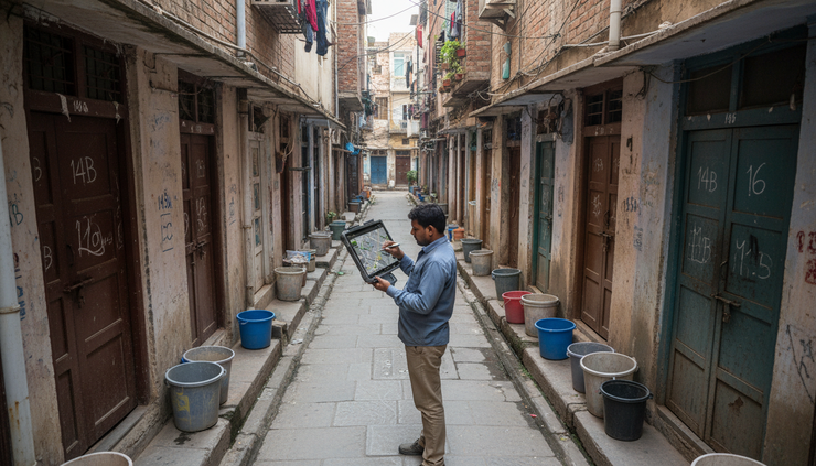
Digital mapping brings field reality into the system. When sanitation staff or survey teams map properties on the ground, they can identify new buildings, unlisted households, changed occupancy, duplicate entries, and areas not linked to any collection route.
Geo-tagged property data helps supervisors verify whether a street is actually covered. It also helps compare the official record with field activity. If a collection vehicle passes a lane but several mapped properties show no collection history, that pattern points to a service gap.
Tools like SafaiMitra can help ULBs combine mapping, field verification, and updated records so that new or missed properties do not remain outside the sanitation system for months or years.
Connected data improves operational visibility
Property information becomes more useful when it connects with daily collection tracking, worker activity, complaints, and service status. A property should not be treated as a passive entry in a register. It should be part of an operational record.
For example, when property data is linked with collection tracking, supervisors can see which homes were served and which were skipped. When it is linked with complaints, a recurring complaint from the same cluster can be checked against route timing or missed visits. When it is linked with field activity, the ULB can identify whether the issue is a route gap, a worker gap, or a record gap.
SafaiMitra is relevant here because it can help bring these signals together: updated property records, collection monitoring, missed-property identification, field visibility, and smarter sanitation planning.
This changes the nature of reporting. Instead of waiting for manual registers or periodic summaries, sanitation teams can use data to see gaps while they are still manageable.

The next step is measurable sanitation
The missed property problem is practical, not abstract. A household that is not visible to the ULB is difficult to serve, monitor, include in reports, or hold within a sanitation plan.
Better property visibility can help ULBs move towards more accountable and measurable urban sanitation. It supports fairer door-to-door waste collection, better ward planning, faster gap detection, and clearer responsibility across field teams.
Solutions such as SafaiMitra can play a useful role by helping cities keep property records current and connected to real service delivery. When every household is visible, sanitation planning becomes less dependent on assumptions and more grounded in what is happening on the street. ULBs that invest in this visibility will be better placed to build cleaner, more efficient, and more responsive cities.
Comments