


GIS Mapping of Properties for Smarter Garbage Collection

Many cities have thousands of households, shops, markets, apartments, institutions, and informal settlements spread across different neighbourhoods. Waste collection teams may know the area from experience, but manual registers and paper-based route plans often make it difficult to answer a basic question: is every property being covered regularly?
This is where GIS mapping of properties becomes useful. GIS, or Geographic Information System, is a way to place real-world information on a digital map. For solid waste management, it can show where properties are located, which routes serve them, where vehicles move, and which areas are missed.
Better mapping does not collect waste by itself. But it gives municipalities a clearer view of the collection network, making planning, monitoring, and follow-up much easier.

What GIS property mapping means
GIS property mapping means creating a digital map of individual properties in a city or ward. Each property is marked with its location and basic details. This may include:
Households
Shops and commercial units
Apartments and gated communities
Schools, hospitals, and offices as property types
Markets and bulk waste generators
Community bins or collection points
Lanes, roads, ward boundaries, and service zones
In simple terms, GIS turns a city into a usable map layer. Instead of seeing only road names or ward boundaries, the municipality can see the actual points where waste must be collected.
Each mapped property can be linked to a unique ID. This helps teams connect the property with a collection route, assigned vehicle, collection frequency, and service status.
Why property-level visibility matters
Door-to-door garbage collection depends on coverage. If the city does not know exactly where properties are located, it becomes hard to confirm whether all of them are being served.
Manual records may become outdated quickly. New buildings come up, shops move, apartments expand, and some streets are added informally. Field staff may know these changes, but the information often remains with individuals instead of becoming part of a shared system.
A digital property map helps create a common reference for the entire waste-management team. Supervisors, drivers, collection staff, ward officers, and city managers can work from the same view.
This improves visibility in practical ways:
Missed properties become easier to identify
If a property is mapped but not linked to any route, it can be flagged for review.
Duplicate or unclear service areas can be reduced
Two teams may unknowingly cover the same lane while another lane is missed. Mapping shows overlaps and gaps.
Complaint handling becomes more specific
Instead of saying “collection was missed in this area”, teams can identify the exact property, lane, or collection point.
New service areas can be added faster
When new properties are mapped, they can be included in the right zone and route.

How GIS supports door-to-door garbage collection
GIS property mapping becomes more useful when it connects with daily collection activity. The map can act as the base layer for planning and monitoring.
Linking properties with collection routes
Once properties are mapped, each one can be assigned to a collection route. This helps the municipality understand which vehicle or team is responsible for which households and commercial units.
A route should ideally match ground conditions. Narrow lanes may need smaller vehicles or handcarts. Main roads may suit larger collection vehicles. Busy markets may need different timings. GIS helps planners see these patterns on a map rather than relying only on memory.
Defining service zones clearly
Many ULBs divide cities into wards, zones, beats, or collection areas. These boundaries may not always match actual collection needs. A GIS map can show whether a service zone has too many properties, difficult access points, or areas that are far from the main route.
With this view, supervisors can adjust workloads more fairly. One team may be covering a compact area with many properties, while another travels long distances with fewer stops. Mapping helps make these differences visible.
Tracking collection points and transfer locations
Door-to-door collection does not end at the doorstep. Waste moves from properties to vehicles, community bins, secondary collection points, transfer stations, or processing facilities.
GIS can map these points and show how they connect. This helps teams check whether:
Collection points are placed where people can use them
Vehicles have practical access
Waste is being moved through the expected path
Overflow points need attention
Identifying missed properties and service gaps
One of the most useful outcomes of GIS mapping is the ability to find gaps. A missed property may not always raise a complaint. Residents may adjust, dump waste nearby, or wait for irregular collection. Over time, this can lead to litter spots and public dissatisfaction.
GIS can help detect gaps by comparing three layers:
Map layer | What it shows |
Property layer | All households, shops, and institutions that need service |
Route layer | Which team or vehicle is assigned to each area |
Activity layer | Where collection actually took place |
If a property exists on the map but has no route assigned, it is a planning gap. If it has a route but no collection activity over repeated cycles, it may be a service gap. If complaints come from the same cluster, that area may need closer monitoring.

Better data for planning and accountability
A city-wide property map creates a stronger data base for decisions. It can support planning at different levels, from daily route assignment to long-term infrastructure needs.
For example, ward officers can use mapped data to estimate how many properties a team covers. Collection supervisors can check whether vehicles are following assigned routes. Smart-city teams can connect GIS layers with vehicle tracking or collection attendance systems.
This also improves accountability. When service areas are vague, it is hard to know where responsibility begins and ends. When every route and property is mapped, responsibilities become clearer.
That clarity helps with:
Planning for new residential layouts
Managing bulk waste generators
Reviewing contractor performance
Responding to citizen complaints
Preparing ward-level reports
Practical steps for municipalities
GIS mapping does not have to begin with a complex city-wide project. Many municipalities can start ward by ward and improve the map over time.
A practical approach may include:
Create a base map
Use ward boundaries, roads, existing property records, and available satellite or survey data.
Conduct field verification
Teams visit lanes and mark actual households, shops, apartments, open plots, and collection points.
Assign unique IDs
Each mapped property receives an ID that can be linked with route and service data.
Connect routes and vehicles
Collection beats, vehicle routes, and service zones are added to the same GIS system.
Update the map regularly
New properties, changed land use, closed shops, and new collection points should be added as part of routine work.
Use field feedback
Drivers and sanitation workers often know route problems first. Their inputs can make the map more accurate.
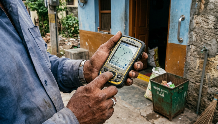
A clearer map leads to cleaner operations
Garbage collection improves when teams know exactly where service is needed and whether it has happened. GIS property mapping gives municipalities that visibility. It connects individual properties with routes, vehicles, service zones, collection points, and field activity.
For ULBs, smart-city teams, and waste-management professionals, the value is practical: fewer unknown areas, better route planning, clearer accountability, and faster identification of missed properties.
A city cannot manage what it cannot see. A well-maintained GIS property map helps turn waste collection from a broad area-based activity into a more precise, property-level service.
Comments