


Every Property Counts Why Every Household Must Be Visible to the ULB

A city can clean only what it can see. When a household exists on the ground but not in municipal records, it can quietly fall outside daily waste collection, route planning, complaint tracking, and service reporting. This is the missed property problem, and it grows faster in cities where new layouts, rental units, informal extensions, commercial conversions, and peri-urban settlements change every month.
For ULBs, sanitation departments, and smart-city teams, property visibility is not just a mapping exercise. It is the base layer for fair service delivery. Digital platforms such as **SafaiMitra** can help connect property records with collection activity, field movement, complaints, and service status, so every household is counted in planning and monitored in execution.

What the missed property problem means
The missed property problem happens when actual properties in a city do not match the properties recorded by the ULB. The gap may include:
Newly built houses not added to municipal records
Rental units created within one registered property
Informal settlements or edge-area homes not mapped
Commercial properties listed as residential, or the other way around
Old records where owners, usage, or occupancy status has changed
Locked, vacant, or hard-to-access properties with no service status update
Indian cities expand in many directions at once. A ward may gain new apartments, small shops, mixed-use buildings, and extended rooms before the sanitation database catches up. If the field team depends on outdated lists, the collection plan may look complete on paper while households remain unserved on the ground.
How inaccurate property data affects sanitation operations
Door-to-door waste collection depends on a simple question: which properties must be covered today? If that list is incomplete, the entire chain weakens.
A missed property may not receive daily collection. A missed lane may not appear in a vehicle route. A new cluster of homes may increase waste volume, but the route may still be planned for older load levels. Over time, this can lead to overflowing community bins, open dumping, resident complaints, and uneven service across the ward.
Inaccurate property data also affects monitoring. Supervisors may see that a route is marked complete, but that only means the known properties were covered. It does not confirm coverage of unknown or unmapped households. The same issue appears in reports. If the denominator is wrong, coverage percentages, missed collection rates, and ward performance dashboards become less reliable.

Why digital visibility matters at ward and city level
Every household should be visible at two levels. At the ward level, teams need to know the exact properties, lanes, collection points, service status, and problem spots. At the municipal level, administrators need a consolidated view of coverage, staff deployment, vehicle movement, complaints, and trends.
Digital visibility creates a shared reference point. A property is no longer just an entry in a register. It becomes a service location with a status. Has it been mapped? Is waste collected regularly? Is it tagged to a route? Has a complaint been raised? Is it newly added, vacant, locked, or underserved?
When such information is available, ULBs can move from assumptions to evidence. **SafaiMitra** supports this shift by helping sanitation teams organise property-level data and connect it with daily field operations.
How property mapping identifies missed and underserved areas
Property mapping helps ULBs compare what exists on the ground with what exists in records. Field teams can verify properties lane by lane, mark new structures, update occupancy details, and flag places that need further review.
This is useful for both planned and unplanned growth. In a planned layout, a new apartment block may need added collection points and more frequent pickup. In an older ward, one registered house may now contain several rental units. In a peri-urban pocket, new houses may have appeared beyond the last mapped street.
Property-level mapping can help identify:
Houses not linked to any collection route
Properties skipped due to access issues
Areas where waste generation has increased
Streets where service frequency does not match need
Locations where complaints repeat despite reported collection
With **SafaiMitra**, property updates can become part of regular sanitation management instead of a one-time survey that becomes outdated within months.
Why property data should connect with field activity
Property data becomes more useful when it connects with real-world service activity. A mapped household is only the starting point. ULBs also need to know whether the service actually reached that household.
This is where collection tracking, field attendance, vehicle movement, complaints, and service status add value. When these layers come together, supervisors can see not only where properties are located, but also what happened there.
For example, if a mapped property repeatedly shows no collection, the issue may be route design, timing, staff shortage, blocked access, or resident non-participation. If several complaints come from the same cluster, the ward may need a route revision or extra monitoring. If newly mapped homes are not assigned to any collection beat, they can be added before the service gap becomes chronic.

**SafaiMitra** can support this connected view by bringing property visibility, collection monitoring, field activity, missed property identification, complaints, and service updates into one sanitation management flow.
Better visibility leads to better decisions
A ULB with updated property visibility can plan with more confidence. Ward officers can assign beats based on actual households, not old estimates. Sanitation departments can check whether service coverage is improving in measurable terms. City administrators can compare wards more fairly because the base data is clearer.
This improves accountability as well. Field teams know which properties they are expected to cover. Supervisors can check exceptions. Residents get a better chance of being included in service delivery. Reports become stronger because they reflect real coverage, not just recorded coverage.
Better visibility also supports resource planning. If a ward adds a large number of mapped homes, the ULB can review vehicle capacity, manpower, route length, and collection frequency. If some properties remain consistently unserved, the issue can be investigated with location-specific evidence.
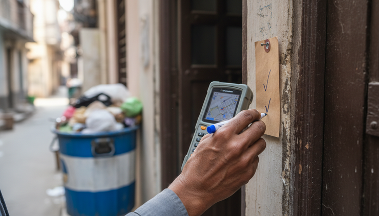
Every property counts in sanitation planning
Clean cities are built through daily, repeatable systems. Those systems depend on knowing where people live, where waste is generated, and whether services actually reach each location. Missing properties weaken that chain. Updated property visibility strengthens it.
**SafaiMitra** is designed to support ULBs in making sanitation data more current, field-linked, and useful for planning. It can help teams maintain property records, monitor collection, identify missed properties, improve field visibility, and make smarter sanitation decisions without turning the process into guesswork.
A household that is invisible in records can become invisible in service. That is why the goal must be clear for every ULB and sanitation team: Every Property Counts. Every Household Should Be Visible.
Comments